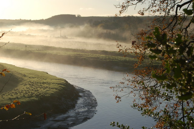
 River Torridge near Annery Kiln. Photo: Thor Beverley / Geograph (CC BY-SA 2.0)
Official route · Sustrans
NCN 27 - Devon Coast to Coast
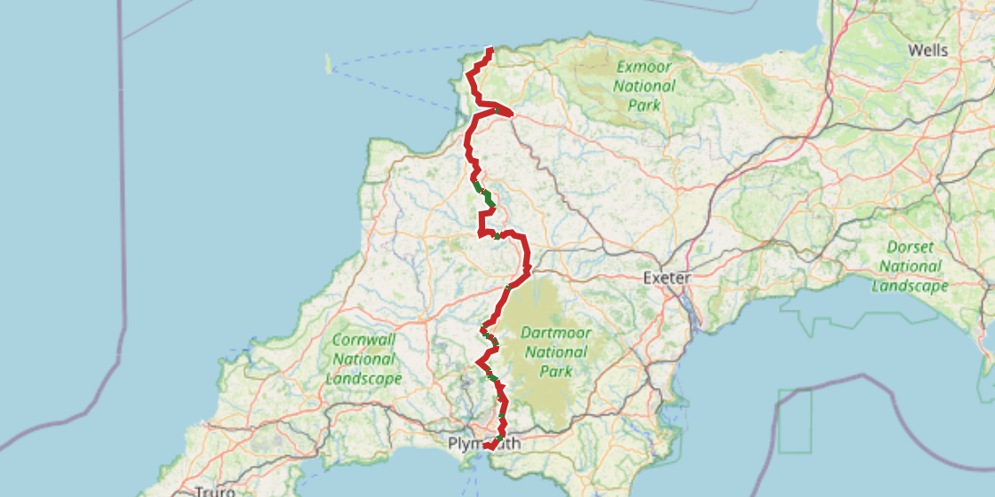
The route runs from the coast at Hele south to Plymouth, crossing North Devon's hilly lanes before the land opens out briefly through Barnstaple and the Taw estuary.
From Bideford the road climbs steadily inland, and by the time you reach Meldon and Sourton you are on Dartmoor proper, exposed and high. The descent off the moor carries you down through Mary Tavy and Horrabridge before the route threads through the suburban edges of Plymouth to finish at Millbay. About thirteen percent of the surface is off road.
The figures
| Distance | 159.5 km |
|---|---|
| Climbing | 1670 m |
| Off road | 21 km, about 13% of the route |
| Riding time | about 9 hours, roughly 2 days at a moderate pace |
| Region | South West England |
| Route from | Sustrans |
Worth knowing before you go
The long stretch between Sheepwash and Chichacott passes through very few settlements, and resupply in that section is limited. Dartmoor between Meldon and Vale Down is the most exposed part of the route and the most serious in bad weather. Barnstaple is the largest town on the line and a practical place to end the first day.
Put your own dates on this and TourTrax splits it into days at your pace, finds somewhere to sleep at the end of each one, estimates what it will cost and gets you to the start without flying.
Plan this route → Download the GPXOther route guides
- NCN 1 - North Sea Cycle Route
- NCN 10 - Reivers Route
- NCN 11 - Fenlands, Cambridge and the Ouse
- NCN 12 - The Great North Way
- NCN 13 - London to Maldon
- NCN 14 - Three Rivers
- NCN 16 - The Flitch Way
- NCN 17 - Pilgrims Way
- NCN 18 - Canterbury to Royal Tunbridge Wells
- NCN 2 - South Coast Cycle Route
- NCN 20 - The Wandle Trail
- NCN 21 - London to Eastbourne
- NCN 22 - Banstead and Brockenhurst
- NCN 23 - Reading to Southampton
- NCN 24 - Bath to Eastleigh
- NCN 25 - Dorset
- NCN 26 - Portbury Dock
- NCN 28 - Dartmoor South Devon
- NCN 3 - West Country Way
- NCN 30 - Norfolk Circular
- NCN 32 - Cornish Way
- NCN 4 - Celtic Trail
- NCN 41 - Severn Avon Vale
- NCN 42 - Chepstow to Hay-on-Wye
- NCN 43 - Swansea Valley
- NCN 44 - Six Castles Way
- NCN 45 - Mercian Way
- NCN 46 - Heads of the Valleys
- NCN 47 - Celtic Trail Upland Route
- NCN 48 - National Byway Central
- NCN 49 - Monmouthshire Brecon Canal
- NCN 5 - North Wales Coast avoiding uplands
- NCN 5 - Thames Midlands North Wales
- NCN 50 - Great Central Cycle Ride
- NCN 51 - Varsity Way
- NCN 54 - Derby to Lichfield
- NCN 55 - Ironbridge to Preston
- NCN 552 - North Shropshire
- NCN 56 - Huyton to Chester
- NCN 57 - Northleach to Chesham
- NCN 6 - London to Carlisle
- NCN 60 - Manchester
- NCN 61 - Maidenhead to Ware
- NCN 62 - Trans Pennine Trail
- NCN 63 - East Midlands Cycleway
- NCN 64 - Melton Mowbray to Lincoln
- NCN 65 - Hornsea to Middlesbrough
- NCN 66 - Central Pennines
- NCN 67 - Trans Pennine Trail Central
- NCN 68 - Pennine Cycleway
- NCN 69 - Morecambe Bay Cycle Way
- NCN 7 - Sunderland to Inverness
- NCN 70 - Cheshire Cycleway
- NCN 71 - Lakes to the North York Moors
- NCN 72 - Cumbrian Coast
- NCN 73 - Kilmarnock to Ardrossan
- NCN 74 - Scottish Borders
- NCN 75 - Edinburgh Glasgow Kintyre
- NCN 76 - Round The Firth Of Forth
- NCN 77 - Dundee to Pitlochry
- NCN 78 - The Caledonia Way
- NCN 8 - Lôn Las Cymru
- NCN 81 - Birmingham to Aberystwyth
- NCN 82 - Hilly Alternative to Lon Las Cymru
- NCN 83 - Dunkeld Lochs Loop
- NCN 88 - South Wales Coast